With summer here, NorthBay biz looks at the various hiking trail projects that aim to give Bay Area residents new reasons to stay outdoors.
The change began in the 1960s, he recalls, with the intrusion into private land of hard-to-evict campers, the breakup of large land tracts and new owners who put up gates and “No Trespassing” signs. With private property off-limits, it fell to regional, state and national parks to create access to public lands.
In recent years, converging desires—to traverse and explore the land, to get outdoor recreation and exercise, and to help fight climate change by reducing auto emissions—have driven a series of comprehensive trail projects throughout the Bay Area counties that open up possibilities for hikers, riders, commuters and tourists. Each of these projects is a story in vision, patience, long-term commitment and community cooperation. Together, they begin to outline a new way of thinking about our public lands and the possibilities of sustainable transportation.
Around the bay by ridge or shoreline
For those who prefer to stay at sea level, the San Francisco Bay Trail, in the works since 1988 and with 300 miles complete, will enable a cyclist or pedestrian to travel the 500 miles around the Bay on a predominantly Class One trail—which means paved and restricted to non-motorized/non-mechanized (except for wheelchair) travel. The Bay Trail is funded by the California Coastal Conservancy and by bonds approved by voters. “All the cities the Bay Trail runs through have supported it,” says Maureen Gaffney, Bay Trail planner with the Association of Bay Area Governments (ABAG). “We connect to a lot of transit centers, job centers, a lot of different neighborhoods and ferries, and it’s just a place where people can get out, enjoy the San Francisco Bay and get some healthy exercise. It’s easily accessible, free transportation.”
If you build it, they will come
Gaffney, who is also board president of the MCBC, says a major motivation is the environmental ethic, which is strong in Marin. In large part through MCBC’s advocacy work, she says, several years ago the county was one of only four communities across the country to share a “really impressive” $100 million appropriation from the federal highway bill for a pilot program called the Non-Motorized Transportation Pilot Program. The county’s $25 million share was used to study whether an investment of significant money in bicycle and pedestrian infrastructure would create a “mode shift” from cars to nonmotorized means of transportation. The idea is, “If you build it, they will come,” says Gaffney.
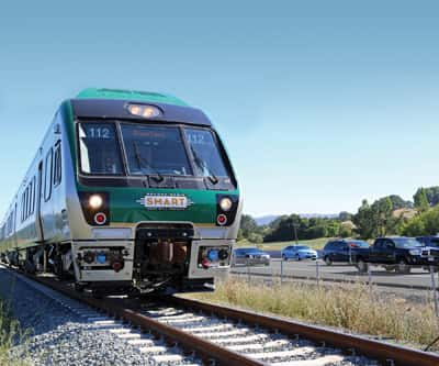
The County of Marin is wrapping up some of the projects right now, including the Cal Park Tunnel and the Lincoln Hill Pathway, and when the new facilities are open, another survey will be made to see whether they’ve had an impact on the way people get around within the county. MCBC worked with multiple agencies for more than 10 years to create the $25 million Cal Park Tunnel (about half the cost was for the bicycle/pedestrian portion, and the remainder is being used to make the tunnel rail-ready for SMART, which is scheduled to begin operations in 2014). This reconstructed railway tunnel, scheduled to open for bikes and foot traffic in October, will allow SMART passenger trains, cyclists and pedestrians (with a full barrier between the trains and others) to go from Larkspur to San Rafael safely out of the way of cars.
A light at the end of the tunnel
“The most important next step for moving the Alto Tunnel project forward is to get engineers into the tunnel to conduct a geotechnical assessment. This will help determine accurate cost estimates, which we don’t currently have.”
This may seem like a long, slow process, but as Gaffney says, “It takes a lot of time and effort to make it all come together.”
A test case in coalition building
A few years ago, if someone said, “Come to Napa Valley—and you can leave your car at home!” one would have thought something was missing in the invitation (not to mention the mind of the person issuing it). Sure, there’s a Class Two bike lane on Silverado Trail, but by the number of homemade crosses, wreaths and other memorial shrines that proliferate up and down the trail, it’s clearly a dangerous road even for cars. So how would anyone get around the valley safely on a bike?
One answer materialized when Calistoga resident, Dieter Deiss, a retired engineer, approached George Goeggel, principal and partner of Auberge Resorts, with an idea for a bicycle trail that would span the entire Napa Valley. Both men had grown up in Europe and missed the culture in which bicycles and walking are thought of not just as forms of recreation, but as a natural mode of transportation. “I said, I think this is a brilliant idea and something I can believe in,” says Goeggel. “The real thought behind all this,” he says, “is to make a very special way to go from one place to another, by walking, jogging or with a baby carriage. So that all people who live here can virtually commute without a car.”
Goeggel and Diess then invited St. Helena landowner Andy Beckstoffer to lunch to see if he thought there was any possibility of selling the idea to other land owners.
“I said, ‘I think so, for sure,’” says Beckstoffer, “if you don’t take any vines out!’”
Beckstoffer didn’t think the concept would conflict with the Ag Preserve ordinance—something he defends as sacrosanct—and actually, it could enhance it. Having a bike trail would let people experience first-hand the “sense of place” in Napa Valley, and that, he says, would “protect our history.” The first group approached with the idea included Eliot Hurwitz, program manager at Napa County Transportation & Planning Agency, who was already working on a the idea of getting people out of their cars and onto bikes. He decided to commission a feasibility study.
That, in itself, was a major accomplishment. The study would cost $100,000—for a bike trail. But the group said, “What’s to lose?” and decided to ask each city in Napa Valley for $20,000. Deiss started with Calistoga and, amazingly enough, mayor Jack Gingles agreed. Energized, the group then went to St. Helena and met with another success. “And,” says Deiss, “the rest is history!”
But it could have remained history, had not a newcomer named Chuck McMinn entered the picture.
In Napa things happen at dinner
“They found out very quickly that, because of the traffic on Highway 29 and the Silverado Trail, it’s really dangerous [to bike] here,” says Deiss. “So Denis called me after the dinner, and said, ‘Dieter, I met a gentlemen you have to meet.’ I was in Chuck McMinn’s office the next day.”
“Chuck McMinn is the great savior of the whole deal,” says Beckstoffer, “because he provided leadership, enthusiasm, time and expertise. He’s a seasoned businessman and he’s used to leading a lot of people. So Chuck really got going on it.”
“Everyone thought they’d just do the study, put it on the shelf, and that would be that,” says McMinn, owner of Vineyard 29 and founder of Covad Communications Group in San Jose, “because they wouldn’t have the resources or the community involvement to take it forward. So we formed the Vine Trail Coalition in 2008 to take over and be a grassroots, nonprofit, public-private partnership that worked to build a hiking and biking trail from Calistoga to the Vallejo Ferry Terminal.”
The coalition now has 19 different local organizations represented on its board. “All the ag interest groups, all the economic interest groups, all the public agencies and all the environmental interest groups,” says McMinn, adding with pride, “no organization in Napa Valley is opposed to it.”
Everyone likes the Vine Trail
For Eliot Hurwitz, the Vine Trail will be the standard bearer for a valley-wide bicycle network and will help bicycling to become an increasingly mainstream mode of transportation in Napa County in the coming decades.
Deiss is thrilled. “I’m very impatient and I like to enact things,” he says. “We have so many plans in life, but my focus has been to actually make the changes happen. To convert a concept into reality is my passion.”
McMinn is the perfect facilitator. “One of the things I love to do is start things up,” he says. “I’ve been doing high-tech startups for 25 years in Silicon Valley. I came up here and did a startup in the wine business—my wife and I own Vineyard 29—and so this was a familiar challenge; it’s another startup. But it’s not just any startup, it’s a legacy startup. It’s a startup that’s going to leave a legacy for everyone in this valley for everybody who’s connected to it. And everybody gets it.”
Summiting Sonoma Mountain
We can accommodate
Bottom line, this is the attitude that’s building success in all these projects, bringing together businesses, tourists, landowners, commuters and locals just out for fun. Whether the task is connecting walking trails through wild land or bike paths from city to city, local counties are changing the way they look at transportation. As a result, excitement is building that the vision of clean, healthy, sustainable transportation and outdoor recreation in our beautiful counties can actually become reality.